Prominence is a measurement designed to set great mountains apart from the range.
We think of The Grand Teton, Mount Rainier, Denali… but few think of San Jacinto Peak (10,834ft), despite the summit having the greatest prominence of any mountain in the contiguous 48 States.
As the turn-around point for Cactus to Clouds to Cactus (C2C2C), the summit affords the unique opportunity to gaze two vertical miles down at the Coachella Valley below. This is the trail runner’s equivalent to a surfer’s quest for the longest wave - a journey that not only requires knowledge and understanding of human movement, but also years of practice.
Rickey's Trail Notes
In the gray, pre-dawn light I studied the outbound tide and the calm, lapping waves. “Never turn your back on the ocean,” read the trailhead sign next to the soft black sand beach. I recalled a friend’s praise of the ocean as “immediate wilderness.”
Trailhead warnings are nothing new. Lightning, bears, snakes, exposure, dehydration — these hazards are always lurking, putting the “wild” in wilderness and giving us stories to tell when we’re safely back in our cars, admiring the patina of dirt and blood on our calves and ankles. I know the toll 50 miles can take on two feet.
An ocean, though, now gave me even more to fret about. I imagined a wave creature emerging from the sea, grabbing me by the shoulders and pulling me into the water without a peep.
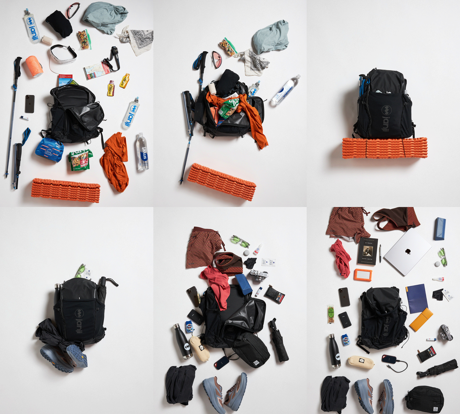
Packing List
5am, parking lot of the Palm Spring Art Museum.
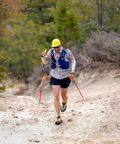
After stashing my overnight bag deep in some thicket at the edge of the parking lot, I lumbered my way up the trail, picking out the route through a tangle of paths that distill down to a singletrack after a half mile. My headlamp illuminated signs painted on the rocks warning ill-prepared hikers and runners of the absence of water for the next 8 miles. A common mistake is to assume that, if you run out of water on the ascent, you can either push on to Round Valley or make the gravity assisted return to town for water - both of which can be (and have been) deadly. Even in cooler months, day-time temps in the valley floor can climb high enough to cause heat exhaustion or stroke.
The sun rose over Joshua Tree National Park to the east, making me, and everything around me, rose-colored. With proper fitness and preparation, the ascent to Round Valley should feel simultaneously unique but routine - the return trip, though almost entirely downhill, can pose as much, if not more, of a challenge as the climb, given the possibility of blisters, dehydration, fatigue or worse.
8:30am, nine miles later.
I climbed past the emerging crags on the steepest part of the trail before leveling off into Round Valley 3.5 hours after I left. After making my way to the Ranger Station to obtain a permit for the summit, I continued up the valley alongside flowing water and a lushness that seemed impossible just a couple miles earlier. The final push to the summit is on the Peak Trail. The air is noticeably cool and thin at this point. A stone hut below the summit can provide some respite on a windy day.
From the summit of San Jacinto Peak I took in the view, a few calories, and began making the long descent back to the Palm Springs Art Museum. The fact that the route starts and finishes at an art museum isn't lost on me. The perfection of the landscape paired with the pure expression of movement through the environment invites an open challenge to the very notion of art.
Trail History:
Like many trail routes, C2C2C is actually several sections of trail tied together to create a cohesive challenge. The majority of the route follows the Skyline trail, which was constructed during the Great Depression by the Civilian Conservation Corp (CCC) to connect the Coachella Valley to the San Jacinto high country, a mountainous area that was already becoming popular.
Little information exists of people attempting to summit San Jacinto Peak from Palm Springs in a single push prior to the 1990’s. The term “Cactus to Clouds” appears to have been coined by Roger Keezer, a member of the Coachella Valley Hiking Club in 1994. The route challenge had been proposed three years earlier by fellow hiking club members, Ray Wilson and Sue Birnbaum.
Prior to the 20th century, the Coachella Valley was and continues to be home to the Cahuilla People - a tribe that adapted to the harsh conditions of the Sonoran desert by situating themselves at the base of the several drainages that descend down from the mountains above. Due to the harshness of the Coachella Valley, and its relative isolation from trade routes, the Cahuilla were largely left alone by European settlers well into the 19th century. The discovery of abundant artesian wells transformed the valley into a vast agricultural zone (95% of the dates in the US come from Coachella Valley), after which proximity to Los Angeles spurred a great interest amongst celebrities in the 1950’s, a trend that spurred the trail's present day popularity.
Getting There:
The trailhead for Cactus to Clouds is one of the most accessible for any trail of its stature in North America. The Palm Springs International Airport (PSP) is a mere 10 minute drive away, while San Diego and Los Angeles are two hours away without traffic. Sleeping in your car before your 3am start? Parking just feet from the trailhead is easy, safe and free.
To summit San Jacinto Peak, a hiking permit must be obtained from the Ranger Station in Long Valley (mile 12). If the return descent doesn’t appear to be in the cards, the Tramway is an excellent way to get back down to the valley floor ($31, last tram down at 9:30pm. You will still need to get from the base of the tram back to the Art Museum).
Difficulty-wise, Rickey rates C2C2C a 6/10. For reference, the Grand Canyon's famous R2R2R is a 7/10.
Run with Rickey
Feeling inspired? Sign up to join Rickey on his next big trail-running trip.
About Rickey
For the past thirty years, running has been a central part of Rickey Gates’s life. Whether it be in the competitive realm of racing or the obsessive realm of curiosity, or a mindful space of meditation, running has long been the primary medium through which Rickey has interacted with the broader environment around him.
In an effort to understand his country, community, and self, Rickey completed two unbelievably ambitious, back-to-back running projects: TransAmericana (2017) in which he ran across the entire United States, and Every Single Street (2018) in which he ran, street by street, the entirety of San Francisco. His current obsession (which you are currently reading) is to paint a picture of North America through trails. He lives in Santa Fe with his wife and two children.


